Manistee North Pierhead Lighthouse
Manistee, Michigan - 1927 (1875**)
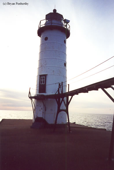

History of the Manistee North Pierhead Lighthouse
This light sits at the end of a pier at the mouth of the Manistee River and Lake Michigan. Access for the keepers would have been by pier or elevated catwalk if the waves were breaking over the pier. The tower stands 39 feet tall and is still active.
Directions: From US-31 heading north out of Manistee, make a left onto Memorial Drive. This will change names to 5th Ave. Continue to follow 5th Ave to the end where there is a parking area for the lighthouse.
View more Manistee North Pierhead Lighthouse pictures
Tower Information
Tower Height: 39.00'
Focal Plane: 55'
Active Aid to Navigation: Yes
*Latitude: 44.25200 N
*Longitude: -86.34500 W
See this lighthouse on Google Maps.
Tower Height: 39.00'
Focal Plane: 55'
Active Aid to Navigation: Yes
*Latitude: 44.25200 N
*Longitude: -86.34500 W
See this lighthouse on Google Maps.