Isle Au Haut (Robinson Point) Lighthouse
Isle Au Haut, Maine - 1907 (1907**)
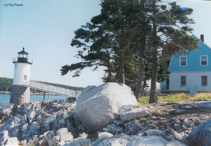

History of the Isle Au Haut (Robinson Point) Lighthouse
Isle Au Haut or Robinson Point as it is sometimes called was established in 1907. The Robinson point name comes from Charles Robinson that sold the land to the Government for the lighthouse to be created. The lighthouse is still an active aid to navigation, but the keeper's house is now a bed and breakfast. For more information on the Keeper's House, please visit The Keeper's House.
Directions: The lighthouse sits on Isle Au Haut Island. Travel to the island can be accomplished by a ferry service that runs to the island. Once on the island, take Main Street to Lighthouse Road. Follow that to the end.
View more Isle Au Haut (Robinson Point) Lighthouse pictures
Tower Information
Tower Height: 40.00'
Focal Plane: 48'
Active Aid to Navigation: Yes
*Latitude: 44.06474 N
*Longitude: -68.65131 W
See this lighthouse on Google Maps.
Tower Height: 40.00'
Focal Plane: 48'
Active Aid to Navigation: Yes
*Latitude: 44.06474 N
*Longitude: -68.65131 W
See this lighthouse on Google Maps.