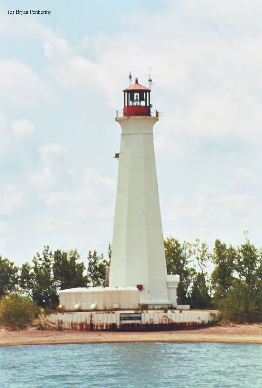
Long Point Lighthouse
Long Point, Ontario - 1916 (1830**)

History of the Long Point Lighthouse
The tip of Long Point Peninsula sticks about 25 miles out into Lake Erie. So many American ships and lives were being lost that the U.S. Goverment had offered to build a lighthouse at the point if the British Government had declined. The British Government had agreed that a lighthouse was necessary at the point, and started construction.
The first lighthouse built at the point was completed in 1833 and stood fifty feet tall. But due to erosion at the point, it was necessary to construct a new tower. The second tower was constructed in 1843 and stood seventy feet tall. The light that shown from this tower was visible 13 miles out into the lake. It served as a lighthouse until the present tower was built in 1916. The second tower was then used as a lookout for the Life Saving Service at the point until it was knocked down in 1929 due to safety reasons.
The present day tower was built in 1916 and stands one hundred and two feet tall and its light is visible across the lake to Erie, PA. The lighthouse received many upgrades through the years...steam power in the 1940s, and diesel power in the 1950s. The Fresnel lens is now an exhibit at the Port Burwell Maritime Museum, which features the Port Burwell Lighthouse.
This is probably the hardest light to access if you don't have your own boat. Reason being, it sits at the tip of Long Point peninsula 25 miles out into Lake Erie. To further make it harder to access, all the land out to that point is part of the Long Point Preserve and is private. Many different species of animals and birds call this area home. The lighthouse is still an active aid to navigation. If you have your own boat, I believe you can land it near the lighthouse as this area is open.
Directions: This lighthouse sits 25 miles out into Lake Erie at the end of Long Point. The only way to see this lighthouse is by boat. We took a lighthouse cruise that was sponsored by the Great Lake Lightkeeper's Association.
View more Long Point Lighthouse picturesTower Height: 86.00'
Focal Plane: 97'
Active Aid to Navigation: Yes
*Latitude: 42.54900 N
*Longitude: -80.04900 W
See this lighthouse on Google Maps.