North Manitou Shoal Lighthouse
Off Manitou Island, Michigan - 1935 (1935**)
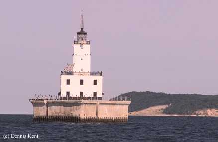

History of the North Manitou Shoal Lighthouse
According to Dennis, the contributor of this picture, lightships marked this area from 1910 until the current lighthouse was built in 1935. It is in 26 feet of water. This lighthouse is one in the part of a series of lights to mark the Manitou Passage. The other light is the South Manitou Island light.
Directions: The lighthouse sits off shore, so the best way to view it is by boat. The Manitou Island Transit offers a ferry service to both North and South Manitou Islands. These tours travel past the lighthouse.
View more North Manitou Shoal Lighthouse pictures
Tower Information
Tower Height: 63.00'
Focal Plane: 79'
Active Aid to Navigation: Yes
*Latitude: 45.02000 N
*Longitude: -85.95600 W
See this lighthouse on Google Maps.
Tower Height: 63.00'
Focal Plane: 79'
Active Aid to Navigation: Yes
*Latitude: 45.02000 N
*Longitude: -85.95600 W
See this lighthouse on Google Maps.