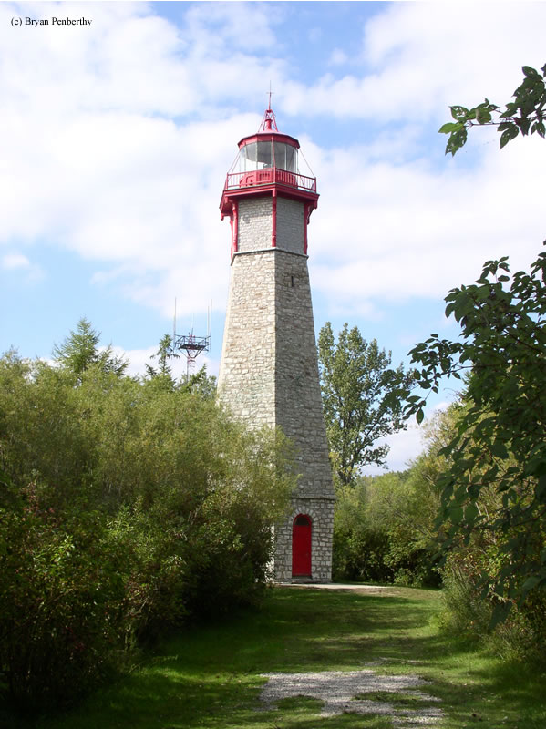
Gibraltar Point Lighthouse
Toronto, Ontario - 1808 (1808**)

History of the Gibraltar Point Lighthouse
The Gibraltar Point Lighthouse was Toronto's first lighthouse. It was built in 1808 and sits out on the Toronto Islands. It was originally 52' tall, and and had a fixed white light that burned sperm oil. In 1832, the lighthouse was raised an additional 30' to bring the total to 82'. At this point, an improved lighting system was installed. After 1863, coal oil was used to light the tower.
Several improvements took place at the lighthouse in 1878. First of all, the balcony around the lighthouse was replaced with iron. And secondly, a new and improved lighting system was installed in the tower. This was purported to be one of the most powerful lights on North American Waters, however, the information is elaborated on to say what type of lighting system was installed.. In late 1916, electricity was brought to the tower, and the light was changed to blink on and off. In 1945, the light was changed to green to help mariners pick it out from the Toronto backdrop.
No lighthouse would be complete without a mystery, so here is the one for Gibralter Point: The first lighthouse keeper, J.P. Radan Muller, was murdered. The York Gazette used these words to descibe the crime... "his murder will be pronounced most barbarous and inhuman." However, from the records no one was ever convicted of the muder...and to this day, it is unsolved. There are tons of stories of what possibly happened, but no hard evidence.
Directions: The lighthouse is located on Toronto Island. You get the Toronto Island Ferry at the foot of Bay Street. When we visited, we went to Centre Island. Once on the island, follow Avenue of the Islands south to Lakeshore Road. There is no vehicles allowed on the island, so you will either have to walk or rent a bike like we did to get to the lighthouse. The lighthouse is about 1.1 miles from the ferry drop off point.
View more Gibraltar Point Lighthouse picturesTower Height: 82.00'
Focal Plane: Unknown
Active Aid to Navigation: Deactivated (1958)
*Latitude: 43.61400 N
*Longitude: -79.38500 W
See this lighthouse on Google Maps.