Presque Isle Front Range Lighthouse
Harbor View, Michigan - 1870 (1870**)
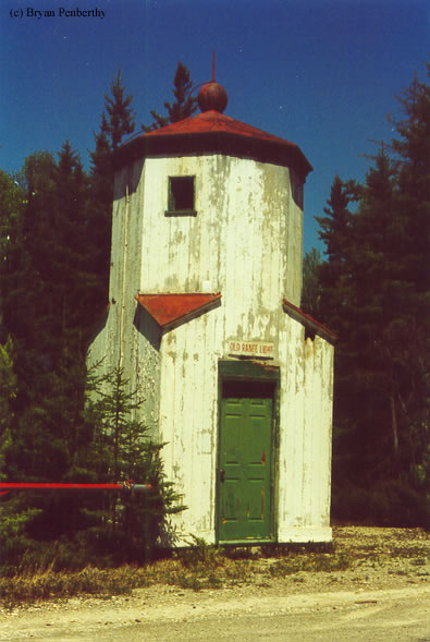

History of the Presque Isle Front Range Lighthouse
This lighthouse has been moved from its area near the Old Presque Isle Rear Range Light to its current area at the entrance of the Old Presque Isle Lighthouse.
Directions: While heading south on US-23 out of Rogers City, take E 638 Highway east to Presque Isle. At the end of E 638 Highway, make a left onto East Grand Lake Road. Follow that north about .8 miles and you will see a sign on the right hand side leading to the Old Presque Isle Lighthouse. At this entrance is the Old Front Range Light.
View more Presque Isle Front Range Lighthouse pictures
Tower Information
Tower Height: 25.00'
Focal Plane: Unknown
Active Aid to Navigation: Deactivated (1960s)
*Latitude: 45.34500 N
*Longitude: -83.48300 W
See this lighthouse on Google Maps.
Tower Height: 25.00'
Focal Plane: Unknown
Active Aid to Navigation: Deactivated (1960s)
*Latitude: 45.34500 N
*Longitude: -83.48300 W
See this lighthouse on Google Maps.