Whitefish Point Lighthouse
Paradise, Michigan - 1861 (1849**)
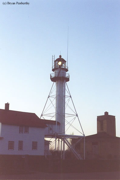

History of the Whitefish Point Lighthouse
Probably one of the most well known lighthouses on all of Lake Superior is this one due to the fact that the Edmund Fitzgerald sank about 15 to 17 miles off shore from this point. The Fitz was making a run south to the safety of Whitefish Point when an enormous winter storm caught them in the open waters. The seas were 12 to 16 feet and category 1 hurricane force winds (+75mphs). The Anderson was following behind the Fitz when they lost radar contact and went out of site. A great source for more information on the Wreck of the Edmund Fitzgerald is Great Lakes Shipwreck Museum.
Directions: From Paradise, follow North Whitefish Point Road about 11.3 miles to the end. This will put you at the lighthouse.
View more Whitefish Point Lighthouse pictures
Tower Information
Tower Height: 76.00'
Focal Plane: 80'
Active Aid to Navigation: Yes
*Latitude: 46.77100 N
*Longitude: -84.95600 W
See this lighthouse on Google Maps.
Tower Height: 76.00'
Focal Plane: 80'
Active Aid to Navigation: Yes
*Latitude: 46.77100 N
*Longitude: -84.95600 W
See this lighthouse on Google Maps.