Point Sur Lighthouse
Big Sur, California - 1889 (1889**)
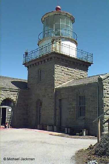

History of the Point Sur Lighthouse
This lighthouse sits on the rocky bluffs along California Route 1 in the Pfeiffer State Park. The park is also home to main hiking trails and redwoods. The station cost the Government more than $50,000 at the time. The reason being was that the lighthouse was built atop a 200 foot rock. This caused major problems during construction. A set of railroad tracks had to be constructed to get materials to the site. Once it was completed, the keepers main access to the site was by climbing 395 stairs. Eventually this was converted to a road way.
Directions: The park is located 19 miles south of Carmel along Highway 1.
From the California State Parks Website: Three hour walking tours of the facilities are available on weekends year-round, and seasonally on Wednesdays. To attend a tour, meet along the west side of Highway 1 at the locked gate 19 miles south of Rio Road in Carmel and 1/4 mile north of Point Sur Naval facility. Space is limited -- arrive 30 minutes early. Call the park for tour information.
The official website of the lighthouse is http://www.pointsur.org.
View more Point Sur Lighthouse picturesTower Height: 48.00'
Focal Plane: 273'
Active Aid to Navigation: Yes
*Latitude: 36.30630 N
*Longitude: -121.90155 W
See this lighthouse on Google Maps.